Sep 17, 2008

parking day is friday sept 19

parking day nyc 2008
http://parkingdaynyc.org/
this blog entry is copied from streetfilms and streetsblog
two blogs that cover livable streets in nyc, yonkers leadership is still trying to build highways through neighborhoods. The new waterfront is a prime example

PARK(ing) Day NYC 2007


this information and video is from streetfilms
Clarence Eckerson, Jr. video

Update: Park(ing) Day 2008 is fast approaching and here in NYC you can apply for a mini-grant to get your parking spot up and running. This year’s Park(ing) Day is doubling in size – with 50 spots coming to the streets of the 5 boroughs. Make sure your neighborhood isn’t left out of the fun! For more info, you can check out www.parkingdaynyc.org.

National PARK(ing) Day was a huge hit here in NYC where Transportation Alternatives & The Trust for Public Land organized a of group of motley advocates in liberating parking spaces to open green areas for city residents to enjoy. Last year, NYC had just one spot, but this year nearly two dozen were sponsored across the city - ranging from a mini-gym on Bedford Avenue in Brooklyn to a tribal village (complete with tee pee!) on Manhattan's West Side.

Parking Day photo
Most amazing was the overwhelmingly positive response the event received. Residents, tourists, commuters, and drivers (yes drivers!) were seen voicing approval. Peds relished the chance to take a seat or diddle their feet in fresh sod. Some ate pizza. Yum!
Related StreetFilms:
T.A. Parking Spot Squat (June 2006)
Rebar PARK(ing) Day 2006 (September 21, 2006)
Sep 14, 2008

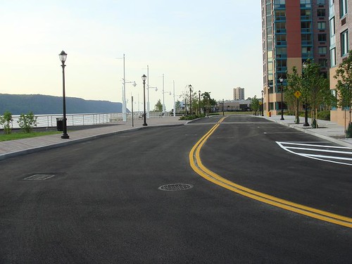
cars already speeding on the new riverfront road


DSC02494, originally uploaded by galvoguy.

yesterday i was down here during riverfest , most of the roads in the area were closed off , however this one was used as the u turn to direct traffic back out of the area. Many of these cars were speeding around the loop posing a danger to the pedestrians and bicyclist.
its a perfect design for speeding cars.
getting hit at 30 or 40 mph may not be deadly or catastrophic to a vehicle occupant, it will be deadly or life changing to a ped or bicyclist,
that is why we don't want conflicts built like this next to or across greenways/bikeways .
This whole new waterfront is built with road conflicts, all of the roadways on the waterfront were unnecessary , they all could have been built on the non river side of the buildings and these areas used as safe public space.
i think i am going to start a new online game show, are you smarter than the Yonkers planners and give the high schools a crack at designing Yonkers waterfront

yonkers missing link of south county trailway


south county trailway, originally uploaded by galvoguy.

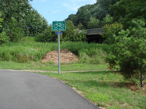
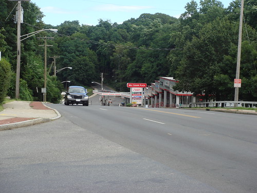
This is what greets the bicyclist heading southbound at the end of the south county trailway in Yonkers.
a very difficult and dangerous commercial road that has to be crossed.
there is an existing railroad tunnel underneath, but for some secret political agreements the south county trailway hasn't been completed in this section.
this is not a safe streets for kids or even adults on bicycles to cross, there is no crosswalk or light here. it is on the crest of a hill and there is fast moving traffic that is not expecting bicyclist to merge.

yonkers missing link of south county trailway


south county trailway, originally uploaded by galvoguy

Railroad tunnel and ROW under highway is straight ahead, no obstacles except local community politics. This is Yonkers unfinished portions of the south county trailway which is built along the right of way of the "Old Putnam Railroad"
the Yonkers portion looks like it would be easy to complete.
local talk is that the residents in the area between tuckahoe road and Cook/ Redmond field have been fighting the completion tooth and nail.
Word is they don't want the trailway ever completed through their neighborhood
Not sure if it is xenophobe or that they have taken ROW land as their own and don't want to stop the trespassing. maybe it is both


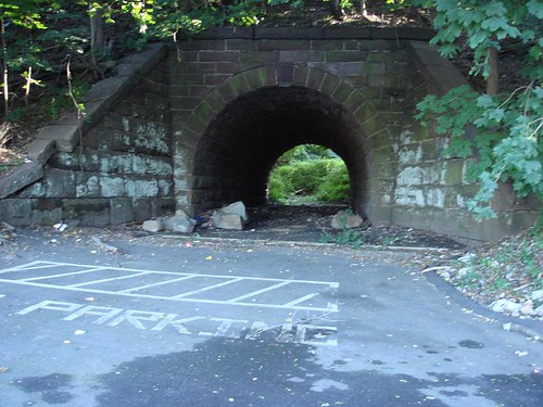
old put yonkers, originally uploaded by galvoguy.

this bridge - arch goes under the old put ROW , this is off mile square and tuckahoe Rd in Yonkers.

this could be used for something associated with the trailway once it is completed.

Sep 13, 2008

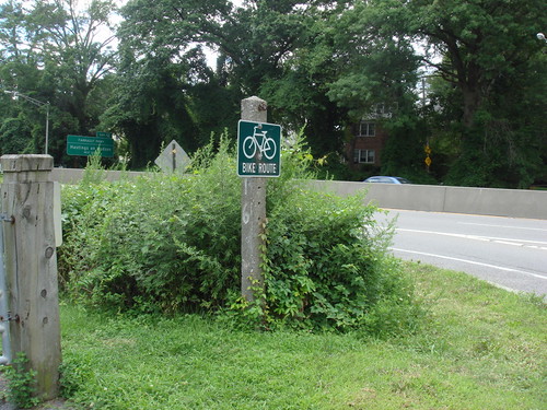
line of sight blocked for bicyclist and exiting cars at saw mill river parkway and Farragut in Yonkers


south county trailway, originally uploaded by galvoguy.

Many of the cars exiting at the Farragut at Yonkers/Hastings border do so at a high speed, this overgrown vegetation creates an added hazard, a line of sight block.
The bike and pedestrian crossing here is one of the most active in the area .This crossing is one of the few that has a high speed roadway crossing it .
photo was taken in august . last week i noticed the vegetation was cut down.

Yonkers Riverfest 2008

Directions to Yonkers Riverfest 2008 this is from the official
Yonkers Riverfest website
anyone else notice what i see as a huge glaring omission and IMO so typical of Yonkers leadership and their thinking.

rule.gif

Directions to Riverfest

FROM SOUTH:

From George Washington Bridge:

Take Major Deegan I87 (becomes NY Thruway) to Yonkers Avenue exit #2. Turn left at Yonkers Avenue. Proceed Westbound on Yonkers Avenue which becomes Nepperhan Avenue. Once on Nepperhan Avenue, follow signs to designated parking areas.

From Sawmill Parkway: passenger cars only
Proceed North on the Sawmill River Parkway to Yonkers Avenue exit. Turn right onto Yonkers Avenue. Proceed Westbound on Yonkers Avenue, which becomes Nepperhan Avenue. Once on Nepperhan Avenue, follow signs to designated parking areas.

Via Train

Take Metro North (Hudson Division) / Amtrak to Yonkers Station. Yonkers Riverfest activities will be taking place in and around Downtown Yonkers in the general vicinity across the street from the Yonkers station.


FROM NORTH:

From Tappan Zee Bridge
Proceed South on New York State Thruway I87 to the Milesquare Road exit #4. Continue South on Central Park Avenue. Turn right onto Yonkers Avenue. Proceed Westbound on Yonkers Avenue which becomes Nepperhan Avenue. Follow signs to designated parking areas.

From Sawmill Parkway: passenger cars only
Proceed South on the Sawmill River Parkway to Yonkers Avenue exit. Turn right onto Yonkers Avenue. Proceed Westbound on Yonkers Avenue, which becomes Nepperhan Avenue. Follow signs to designated parking areas.

From Sprain Brook Parkway: passenger cars only
Proceed South on the Sprain Brook Parkway to Central Park Avenue South exit. Continue South on Central Park Avenue. Turn right onto Yonkers Avenue. Proceed Westbound on Yonkers Avenue which becomes Nepperhan Avenue. Follow signs to designated parking areas.

Via Train

Take Metro North (Hudson Division) / Amtrak to Yonkers Station. Yonkers Riverfest activities will be taking place in and around Downtown Yonkers in the general vicinity across the street from the Yonkers station.